Route Network API & Database

Solving challenges for our Solution Partners

  • Vessel-tracking and voyage-prediction services.
  • Providers of Weather Routing and Optimisation
  • Voyage performance monitoring and optimisation services
  • Commercial shipping and logistics services
  • Solutions for autonomous shipping

Route Optimization

Routing solution and data providers such as companies working on optimisation for fuel saving and efficient voyage calculation.

Voyage Planning

Fleet voyage-planning and monitoring systems for ship owners, operators, and charterers.

Tracking

Insurance companies, working with the shipping industry – for tracking on-board safety-related measures.

Automatic Routing

Ship and fleet automation systems developed and used by service providers for the shipping industry such as solutions for autonomous shipping.


What is a Route Network & Routing Service?

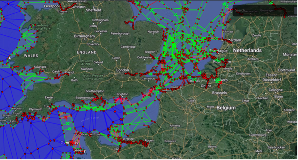
Route Network API 1

  • Our routing service is based on a worldwide network of ports, waypoints and leg lines – referred to as the Route Network.
  • The aim of the routing service is to provide a fully automated route plan, adjusted for specific vessel parameters; the plan factors-in nautical information, administrative and environmental restrictions affecting navigation, the latest Notices to Mariners, and warnings.
  • The routing service could be delivered to Solution Partners as a Route Network Database or as automatically calculated routes delivered via the Route Network API.
  • The Route Network has been combined with the route-calculation algorithm that uses additional data, such as gridded depth information, No-Go Areas , and restricted areas. This enables the safest possible navigable route to be calculated between any geographical locations in the world.

Why Integrate our Route Network and Routing Service?

  • Our team of navigational experts (Master Mariners) uses various sources for extending and updating the Route Network. . Embedded into the Route Network, the final data structure and the attributes, sourced from nautical charts, sailing directions and local routing regulations, can handle even complex routing scenarios.

  • The Route Network is constantly updated with supporting metadata; this is done to allow for computerised route-finding by algorithms that have all necessary and relevant information available to calculate the best route that is safe, appropriate and efficient.

RNW API Key Functions

  • Calculation of shortest safe route via API Calls or RNW Server Web user interface

  • Route calculation, taking into account vessel parameters such as length, beam, static draft, safety margins, vessel type and cargo type.

  • Configuring and adjusting voyage parameters, e.g., defining the port of departure/destination, points and areas to be avoided or passed through.
  • The RNW Server API response, containing the route file in RTZ format, always includes a set of waypoints and schedule.
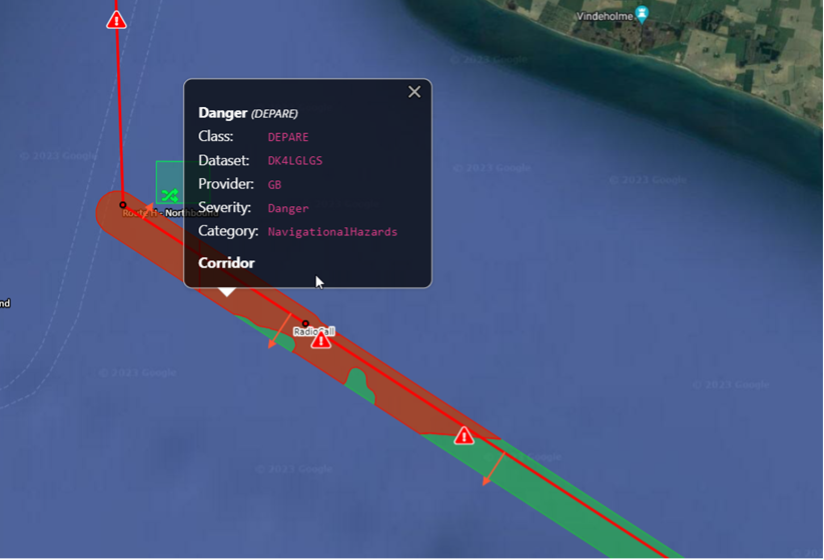
  • The route file includes information required for  creating a voyage plan compliant with requirements, such as voyage segments, XTD, safety route check, points of interest, and restrictions along the route.

Route Network API 2

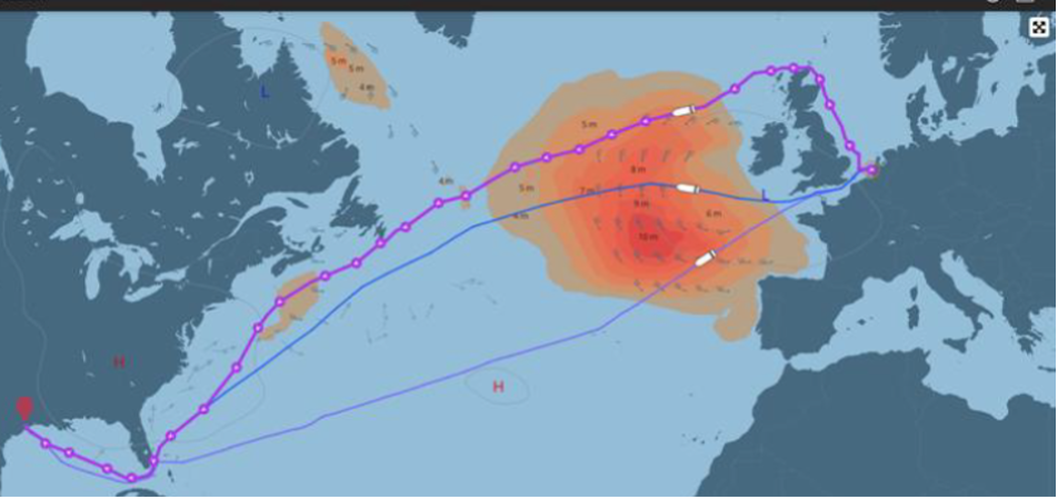
  • Option to add weather routing to the RNW API Calls.  The route calculated with the Weather Routing API will include information about the weather forecast, and vessel performance for the voyage (fuel consumption, cost, CO2 emission, predicted CII rating).

Route Network API 3


We hope to meet your expectations and look forward to hearing from you soon. Please do not hesitate to contact us if you should require further information.


SevenCs GmbH
Zirkusweg 1
D-20359 Hamburg
GERMANY

Phone: +49 (0) 40 851 72 40
Fax.: +49 (0) 40 851 72 4 79
E-Mail: [email protected]