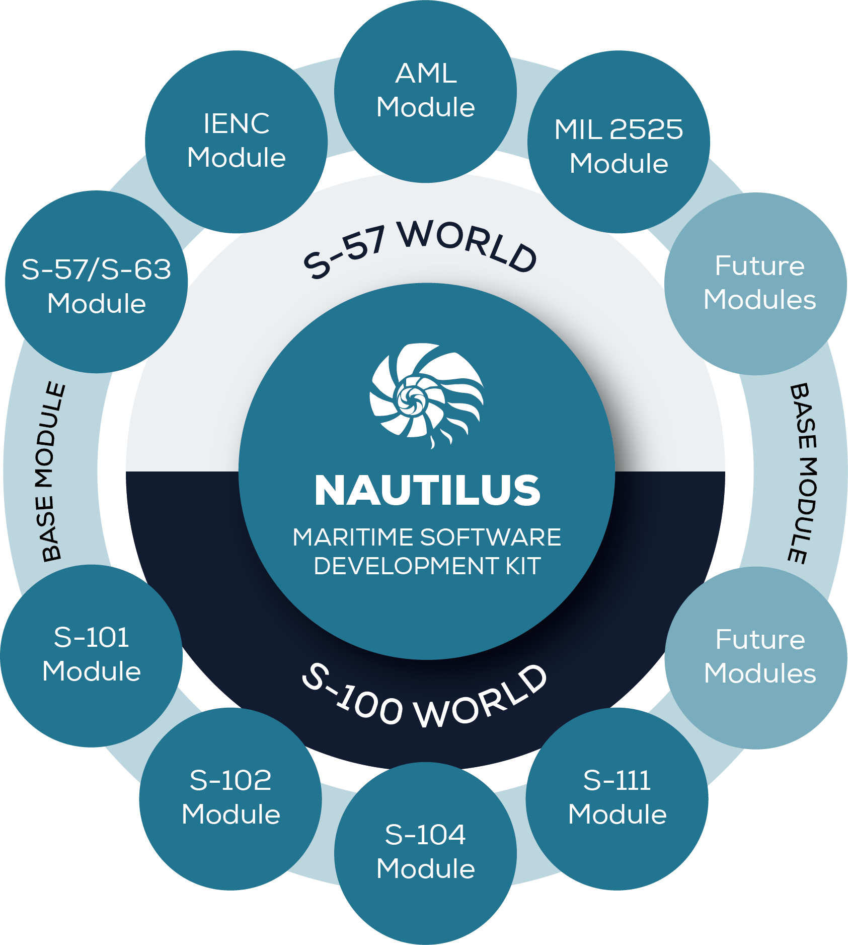
Nautilus Maritime Software Kernel
Nautilus Maritime Software Kernel is the next-generation software development kit (SDK) for maritime applications. This leading S-100 compliant Kernel enables the rendering of a multitude of maritime and military chart formats compliant with the IMO, IHO and IEC requirements for type-approved bridge equipment. The Nautilus Kernel also provides the fastest and easiest chart-import technology ever, no matter whether used in ECDIS, ECS, shore applications, recreational products or tactical displays. Overall, SevenCs combines the longest SDK experience in the market (more than 40,000 licenses sold worldwide) with cutting edge technology, and the Nautilus Maritime Software Kernel sets a new benchmark for maritime SDKs.


Product Highlights:
-
· S-100 Framework compliant ·
-
Hardware accelerated rendering ·
-
Fast, easy and ready-to-use chart import toolbox ·
-
C++ and C# programming interface ·
-
Ready to support Windows, Linux and Android applications ·
-
Military chart product support

Functional Overview:
SUPPORTED PROGRAMMIMG INTERFACE
- C++ (C++ 11)
- C# (Windows only)
SUPPORTED FUNCTIONALITY
- The Nautilus Maritime Software Kernel supports a wide range of core functions for:
- Chart Handling (loading, decryption, updating)
- Chart Display (automated chart selection depending on position and scale)
- Chart Object Handling (creation, manipulation)
- Flexible Data Querying
- Anti-grounding
- Sensor Handling (NMEA, AIS, ARPA)
- AIS and ARPA target display
- Routing (planning, calculation, monitoring, recording)
- Geodetic calculations (Coordinate Reference Systems, Datum, Projections, Spheroids, etc.)
- Includes the EPSG Geodetic Parameter Data Set
- Geometric algorithms in the Cartesian coordinate space
SUPPORTED OPERATING SYSTEMS
- Windows 10/11 (VS2017/2019/2022- 64bit)
- Ubuntu Linux 22.04
- Linux Red Hat 8.0/9.0
SUPPORTED CHART FORMATS
The Nautilus Maritime Software Kernel supports a wide range of data formats for vector and gridded data, such as:
- IHO S-57 Vector Data
- IHO S-100 Vector Data
- IHO S-100 Gridded Data
- GeoTiff
- GRIB (Gridded Weather Data)
- Digital Terrain Models
SUPPORTED CHART PRODUCTS
- Electronic Navigational Chart (ENC)
- Inland ENC (IENC 2.5)
- Bathymetric ENC (bENC)
- Admiralty Information Overlay (AIO)
- ChartWorld Information Overlay+ (CIO+)
- Additional Military Layer (AML 3.0, 2.1)
- ARINC Airborne data
SUPPORTED STANDARDS
- IMO Performance Standards
- IEC 61174 Ed.4 and 62288 Ed.3
- IHO S-100, S-57, S-52 and S-63
- EU Inland ECDIS Standard
- STANAG 7170 (AML)

1 – Subject to change


